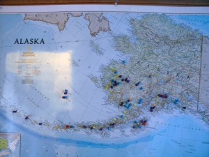
 Our cruise liner “Zuiderdam”, Holland America Lines, sailed for one week (August 11-August 18, 2012) to Alaska belonging now to the USA. Here is the map of Alaska.
Everyone knows that once since 1732 till 1867, Alaska was a Russian territory.
How was everything starting up?
Shortly after ascension to the throne Catherine the Great granted the noble status to Sven Waxell, who in 1742 brought home the survivors of Bering’s ship, and to his posterity.
Here is a plate with noble status.
In 1741 in the vicinity of 55 degrees 30′ north latitude, Chirikov and Bering sighted the coast of the Gulf of Alaska and the coast of America. Some members of their crews, including the captain of the flagship, the Sv. Petr, Sven Waxell, and the naturalist Georg Steller went ashore on Kayak Island. Years later, those landfalls would determine the boundary of Russian America -and the state of Alaska.
To-day we are in the waters and lands of Alaska. The reasons why Alaska was sold to the USA in 1867 by the Russian tsar Alexander II won’t be debated in the article.
We: myself, Janko, Larisa and Gleb are touring around the city of Ketchikan in search of natural beauty.
This our photo presentation from there;”Ketchikan, Alaska, summer 2012″
Do you see the similarities of the Russian and Alaskan nature?
Yes, we do.
